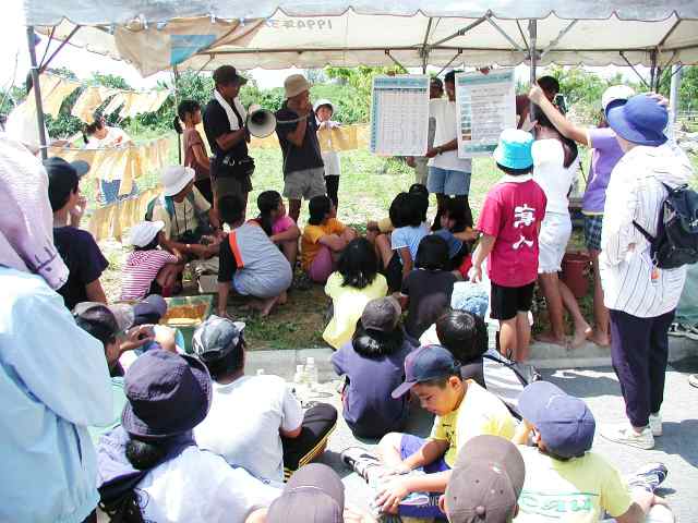
and Ms FUJII, who belongs to the Diving Committee,
announced the total data.
Nature
Conservation Bureau.Ministry of the Environment.Government of Japan
Results
of coral reef monitoring in the Ishigaki Island
Change
of coral cover and coral community at each survey point
The
same point comparative photograph for three years (recovery
good choice)
|
|
|
|
|
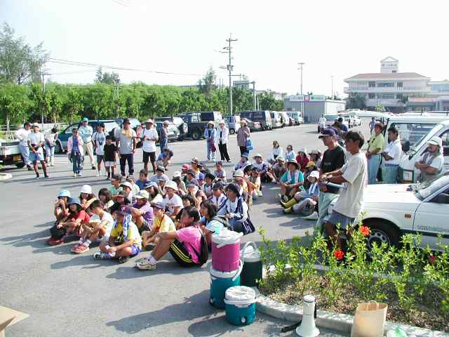
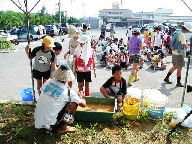
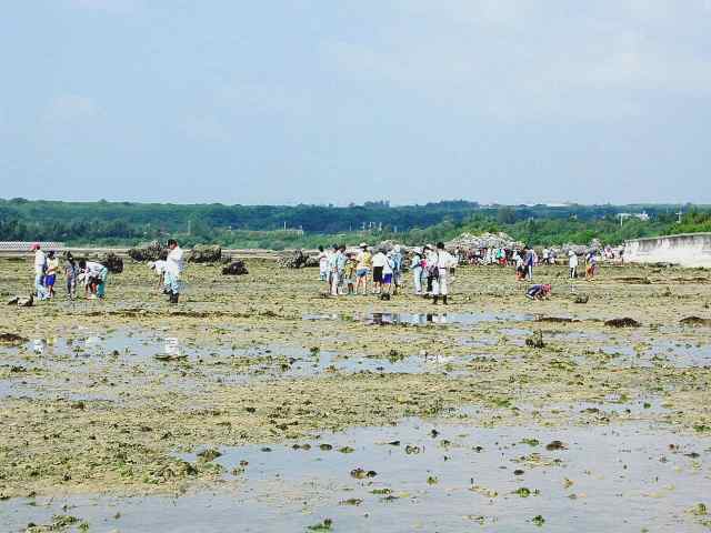
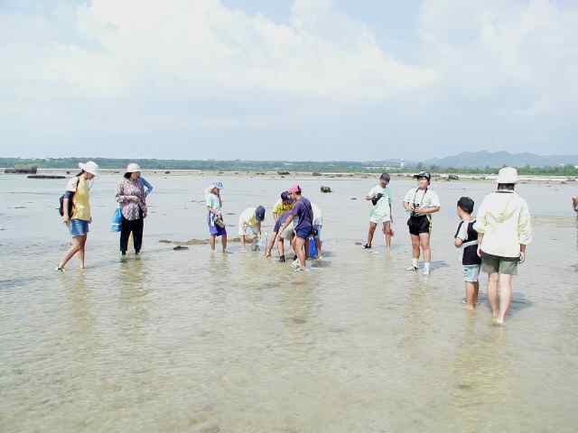
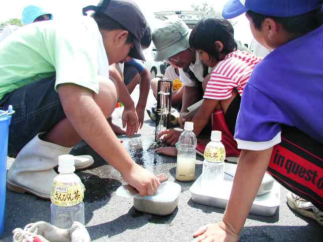
| This survey started at 9 o'clock in the morning. The wide parking lot was filled with cars and more than 100 people gathered! | Before going to the field, we soaked the prepared cotton cloth in the red clay. | Deviding in 7 groups, we went to the stake of the fixed points in the wide MIYARA bay at the low tide and collected red clay. | Pleasant surveys with natural observations were practiced as far as the fixed point stake in 1km from the shore. |
|
|
|
|
|
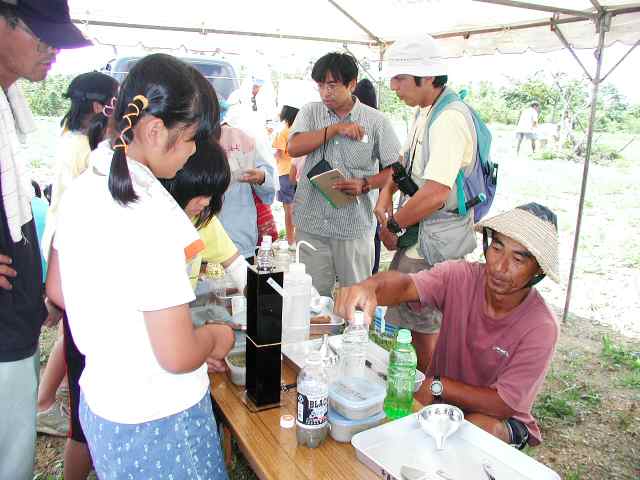
| Mr TANAHARA, who is an Ishigaki Island Eco Tour contact, measured the collected red clay by the clairvoyant occasion meter with children. | Mr NAKADA, who belongs to a red clay group in the YAEYAMA Fishing Department, measures the red clay wearing KUBAGASA (the unique hat for OKINAWA fishermen). | Mr SASAKI ,who is an executive committeeman tied a twisted towel around his head,washed and dried the cloth dyed the red clay, which prepared before the departure. | Mr YASUMURA, who belongs to WWFJ-Siraho Coralvillage, and Ms FUJII, who belongs to the Diving Committee, announced the total data. |
November 12, 2000
This
is the torrential downpour which is typical in the tropical legion.
 |
 |
 |
 |
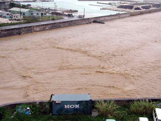
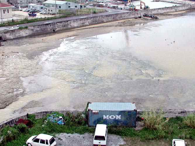
| Both are the photos of ARAKAWA River's mouth which adjoins a fishing port.Left was taken at about 6 p.m. after a heavy rain on November 12. Comparing with the right one, You can see how much the red clay had flowed into the sea. | It in the photography (It is confirmed with the blue
container of the
front.) low tide time from the point which the same time on the
previous
day is the same as on November 11. |
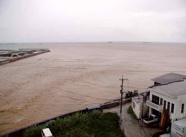
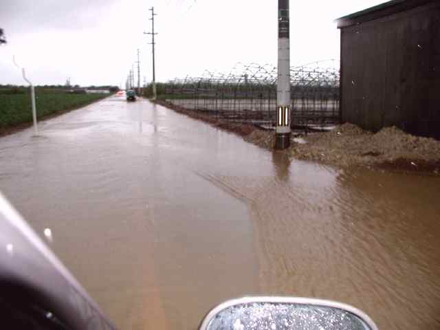
This red clay will reach to the opposite side, TAKETOMI Island.You can clearly see the border line between the blue sea and the red clay. | The road paralleling the coastline was flooded by the
rainwater mixing
with the red clay at about 6 p.m. after a heavy rain on November 12. |
 |
 |
 |
 |
| This flooded red rainwater flows into the sea through the sewer-road,which has built by The Ministry of Agriculture, Forestry and Fisheries.This is the actual state of goverment enterprise for the agricultural land base repair! | This red clay is overflowing unmown sugarcane fields and
flows into
the road.The necessary soil for agriculture has lost by this flood. |
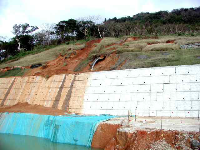
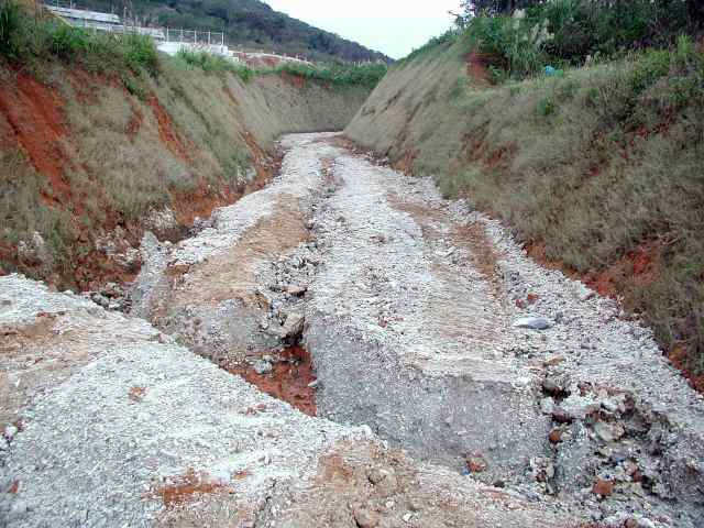
This photo is the construction site of NOSOKO water purification plant which has already collapsed on November 11(the day before a heavy rain).You can see the crack in the wall which is the proof of whole backside moving. | This road leads to the upper water tank but it is too steep to use because of lacking design considerations.The earth and sand flowed through this road and filled up with the fields. |